An insider look: hiking the Inca Trail
In 2012 our erstwhile Marketing Manager Laura wrote a great blow-by-blow account of her trek along the Inca Trail to Machu Picchu. We’re reposting it here because the information is just as relevant as it’s ever been. Read and enjoy…
For me, the Inca Trail was a rite of passage. One of the most famous treks in South America and with global name recognition, the hike had been on my to-do list for a while now. I’d heard friends rave about their experiences on the trail and read about it in everything from travel blogs to Time Magazine.
And of course, my colleges here at SA Expeditions sell the expedition daily. I simply had to take on the trail.
Pre-trek anxiety
My other concern was altitude. The Inca Trail tops out at altitudes surpassing 13,500 feet above sea level (altitude sickness can kick in at a mere 8,000 feet). I side-stepped this issue by arriving in Cusco three days before the start of my trek, giving me time both to adjust (Cusco itself is a lofty 10,900 feet) and taste test some of the city’s best restaurants (it’s the epicenter of modern Andean cuisine).
Inca Trail: Day 1
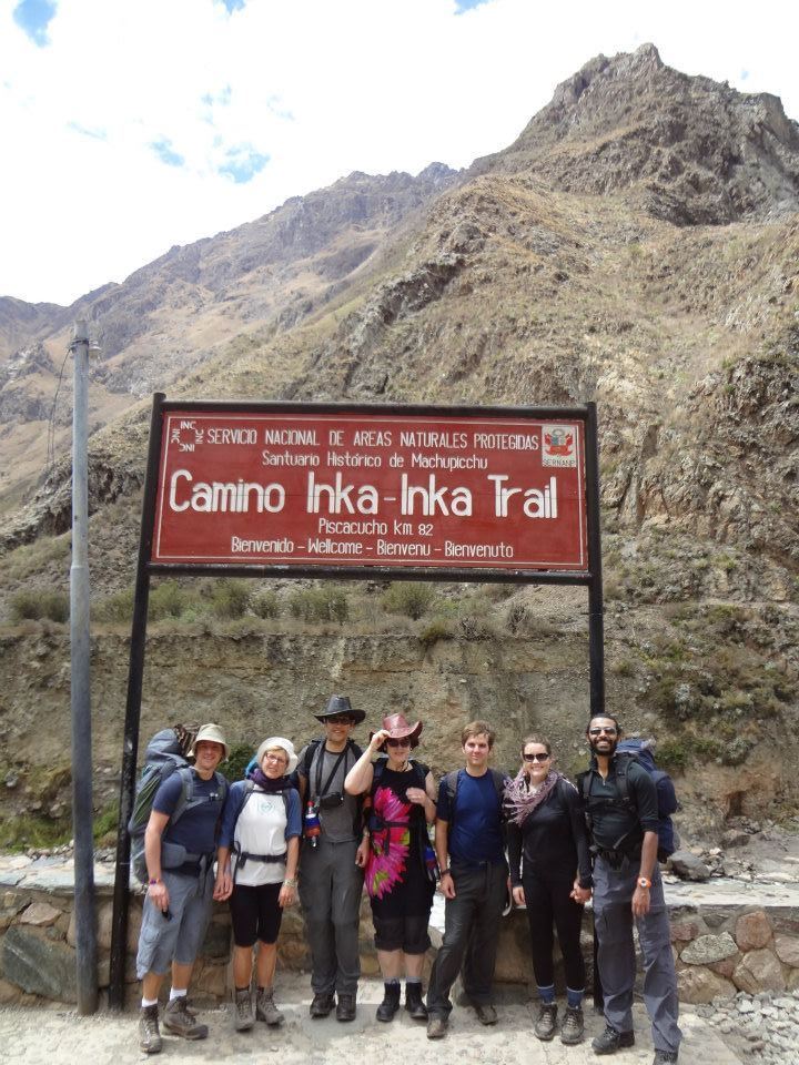
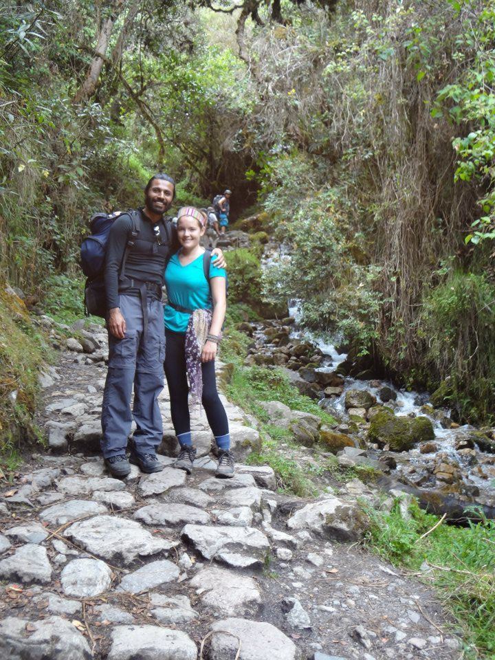
I found the first day surprisingly manageable. With only 7 miles to cover and altitudes lower than Cusco, I was feeling pretty fit. I was also feeling pretty social. All SA Expeditions groups are small and my group had only seven people. In addition to me and my boyfriend (who unlike me didn’t opt for the personal porter), we were joined by an Italian couple on their honeymoon in Peru, an entertaining British couple, and an adventurous American.
Every group on the Inca Trail is also accompanied by several porters, a cook, and a guide. Porters carry all the camping and cooking equipment except for sleeping bags and personal water bottles. All the support staff are from local communities, meaning most speak Quechua and are accustomed to a rural Andean lifestyle. I was impressed every time a porter zoomed past me on the trail with a pack 10 times the size of mine on his back. Porters are not allowed to carry more than 44 pounds each, a regulation that’s strictly enforced…Our head porter even carried a pull scale to make sure the weight was evenly distributed among the staff at the start of each day.
The first day of the Inca Trail trek is a dirt path that twists among local villages and scattered rural houses. Locals lead mules along the path to transport goods to their isolated houses and sell snacks and drinks to passing trekkers for additional income. Lunch can become a community affair with ducks and piglets wandering around the tents.
Since I’m not a big breakfast person, I couldn’t finish the generous serving of eggs and toast. I gave it a good try, though, because our guide, Jose, informed us that the second day is commonly considered the hardest. I figured I’d need all the energy I could get.
Throughout the morning a gradual uphill portion of the trek follows a bubbling brook flowing with glacial waters. The first outlook, Llulluchapampa, is a great place to rest and lunch before tackling the highest peak of the entire trek (some groups prefer to eat lunch at the final campsite, you can decide this as group in the morning).
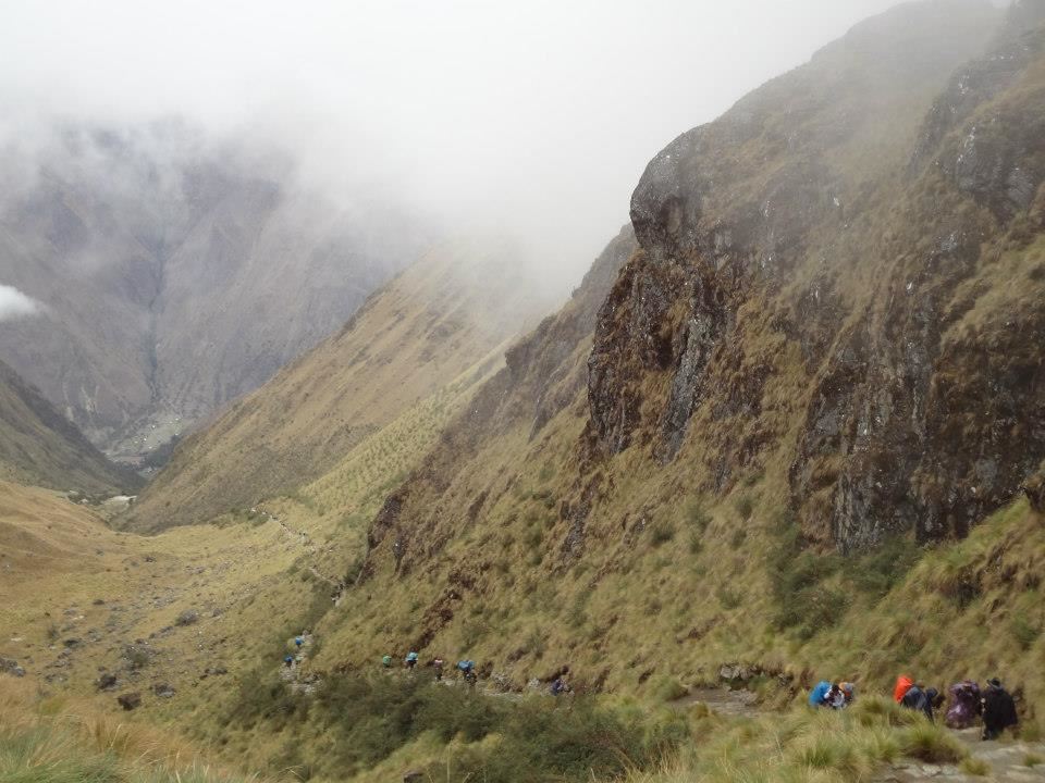
Now for the big one: Warmiwanuscca, commonly and colorfully called Dead Woman’s Pass (supposedly for the contour of the mountain, and not because getting there will kill you). This is the highest point of the trail, topping out at 13,830 feet above sea level. For a bit of comparison, the highest mountain in the continental United States reaches 14,500 feet.
This one was a struggle. The path continued upward and the scenery changed again. We slowly left the grassy valley behind as we trudged toward the pass that loomed in the distance. Unlike the morning portion, the trail was now completely out in the open, with no tree cover or major turns, allowing me to see everyone ahead and behind me plodding along with packs on their backs like a long line of worker ants.
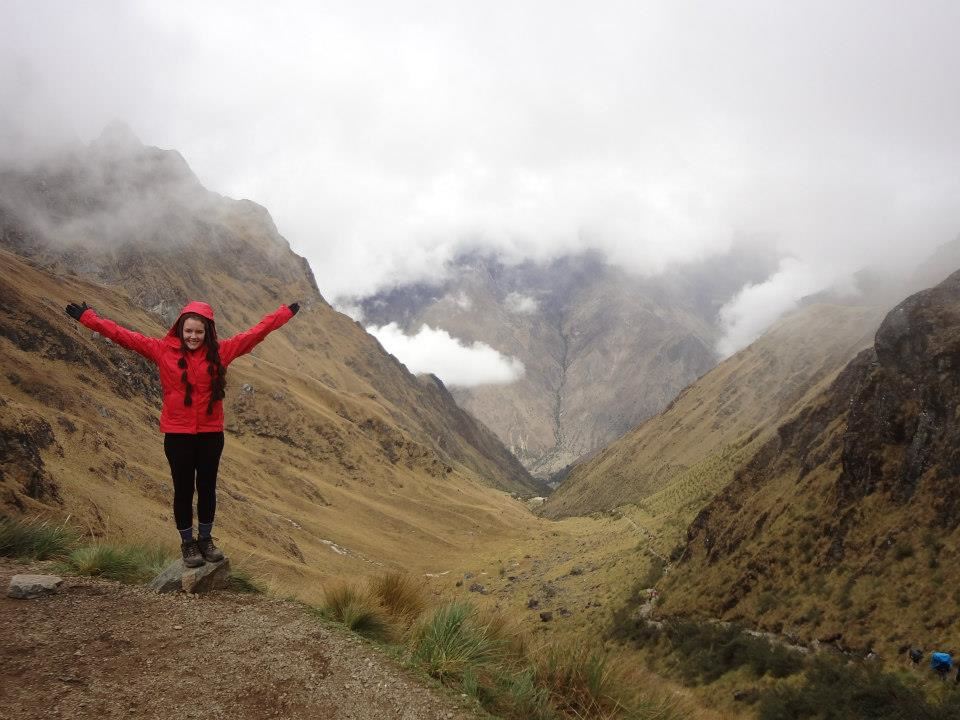
The sense of accomplishment when I reached the top was a rush. The scenery was spectacular, even though it flickered in and out with rolling clouds. After some victory photographs and a rewarding snack, we started our steep descent down the other side, which was like walking through a cloud. Visibility was limited, the steps slippery, and the wind wicked. It encouraged me to scurry as swiftly as possible down to our campsite. After lunch I snuggled into my sleeping bag, emerging several hours later for some hot chocolate, popcorn and a game of cards with my trek mates.
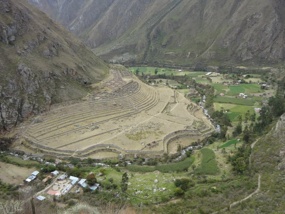
Today is the day for archaeology lovers. The path takes you past several Inca sites, building anticipation for the final citadel. (To see photos of all the specific ruins visit our Inca Trail album on Flickr.)
After waking up to a hot cup of coca tea delivered to my tent by a friendly porter and another filling breakfast with the group, we started off on the longest day of trekking (about 10 miles). Although day started with some uphill hiking, the altitude was much lower. That said, being slightly sore and sleepy from the long day prior, I found this morning to be the most difficult.
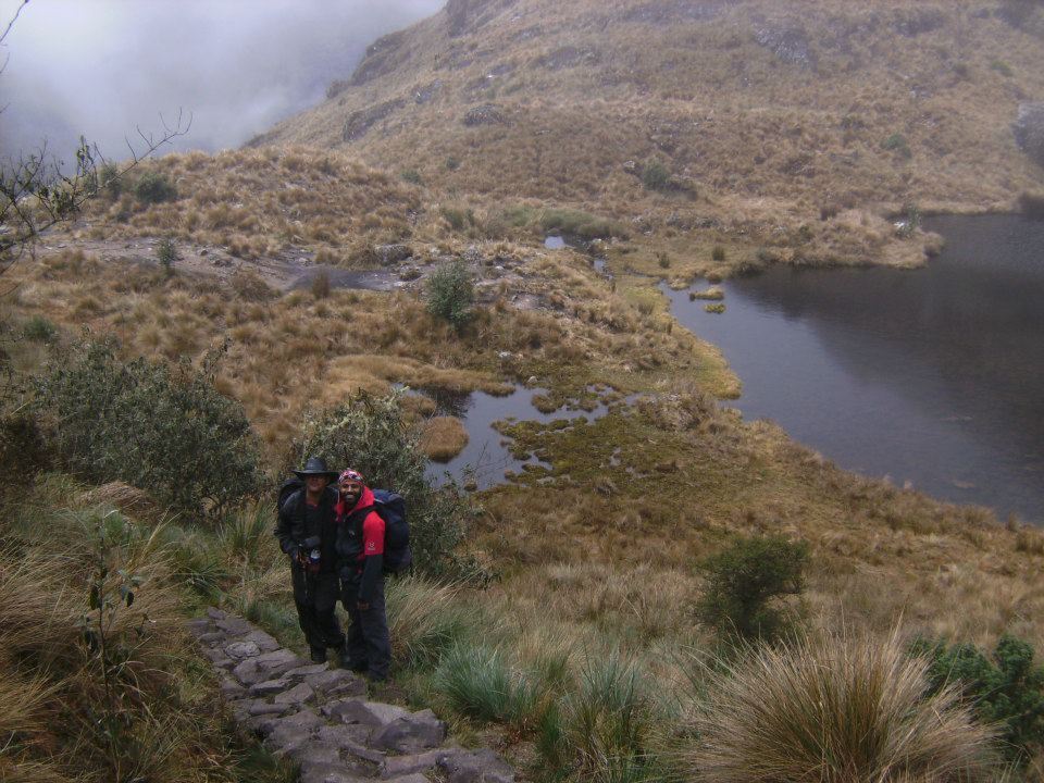
The landscape changed yet again, and we soon found ourselves passing lakes that reminded me of the lochs in Scotland. The air was moist and orchids became more common. Jose shared a seemingly endless amount of information about the local flora and fauna and had a keen eye for spotting tiny hummingbirds and bugs.
Returning to the main path, we were protected from a light drizzle by overhanging bushes and trees. The last incline of the day leads to the ruin site at Phuyupatamarca, where trekkers are treated to a wonderful view across the valley toward Machu Picchu Mountain.
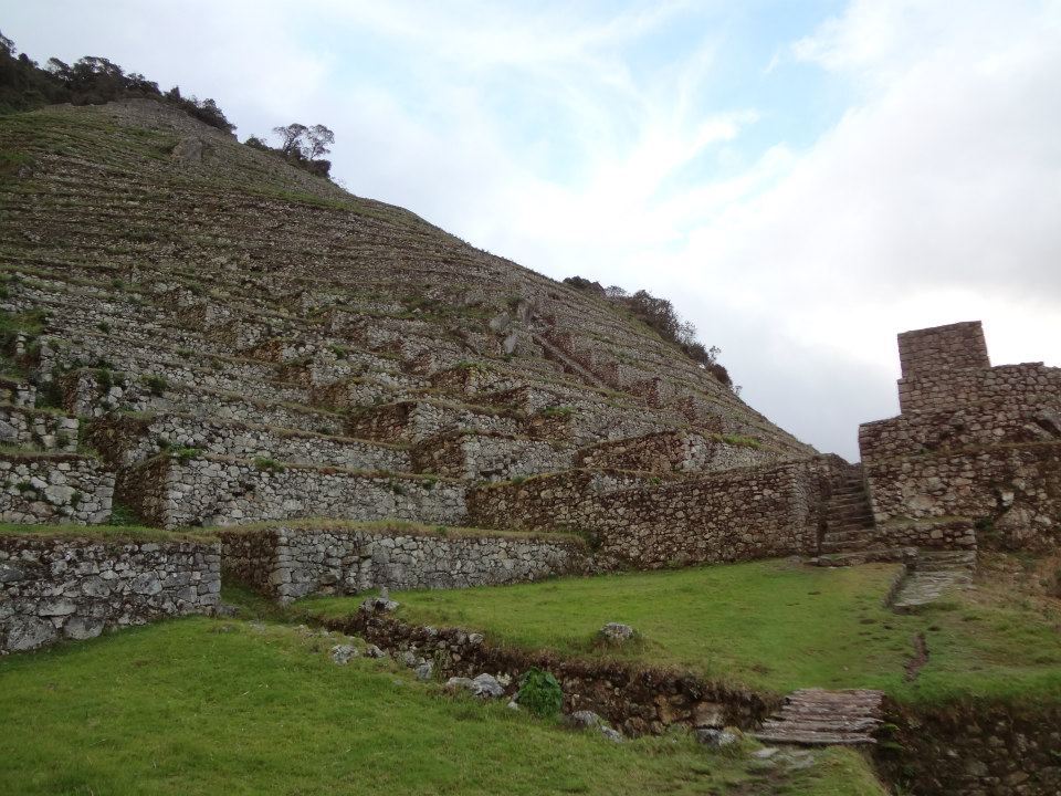
The grand finale of day three was Intipata which overlooks the final night’s campsite and the Urubamba River, far below. This steep series of massive terraces covered with green grass is the perfect spot to watch the sunset before heading down to the campsite for dinner.
Inca Trail: Day 4
Today begins long before the sun rises, around 4 a.m. After an agonizing wait at the official entrance gate, we’re let loose to race to the Inti Punka, more commonly known as the Sun Gate.
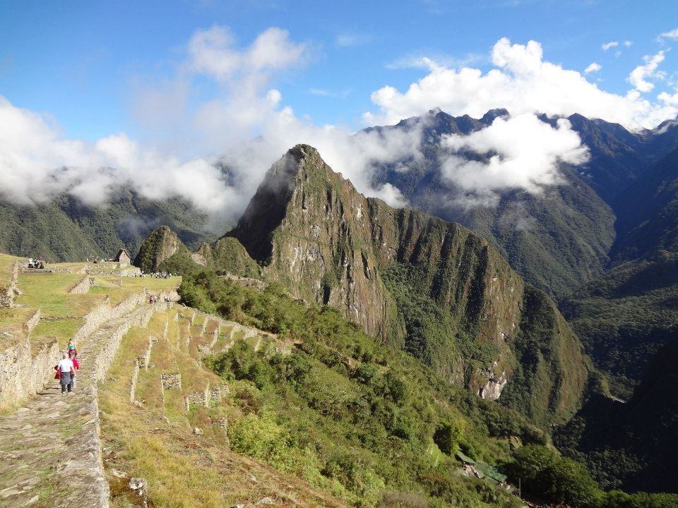
It takes about an hour and a half along a fairly level path followed by a grueling final staircase to reach the Sun Gate, where you get your first glimpse of Machu Picchu—if the weather plays ball. After three days of sporadic mists, we weren’t surprised to find the site hidden behind a swirling gray abyss. No matter. After our entire group made it to the top, we took the celebratory photos and headed down towards Machu Picchu.
As we followed the Inca Trail toward the main citadel, the sun burned its way through the clouds – right on cue. The sight was splendid; the sense of accomplishment enormous.